Showing posts with label Hachioji-shi. Show all posts

Sunday, April 10, 2016

284 多摩森林科学園の桜保存林 - Sakura Preservation Forests in Tama Forest Science Garden


Early Apr '16
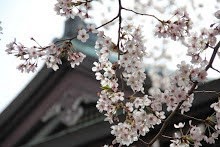
 八王子市の西部、高尾にある多摩森林科学園には、広大な桜保存林があります。

Early Apr '16
Early Apr '16
日本全国の桜が約250種類(野生種、品種改良種含めて)1400本が植えられ、保存されているため、1か月近く桜を楽しむことが出来ます。

Early Apr '16
Early Apr '16
桜だけでなく、蝶や鳥などの動物たちもたくさん住んでいます。
Early Apr '16
Early Apr '16
Early Apr '16

Tama Forest Science Gardens located in Takao, Hachioji, Tokyo.

Early Apr '16
This place is famous for Sakura Preservation Forests which is large area and about 250 species both wild and cultivated species, 1400 Sakura trees are planted.
Therefore, we can enjoy Sakura for a month.

Early Apr '16
View to the central Hachioji
Early Apr '16
Not only Salura but also many butterflies and animals live in this forest.

Early Apr '16
Early Apr '16

==========

9:30 - 15:30 (16時に閉門)
4月は9:00開園。

休園日
毎週月曜日(3月4月は無休)
月曜日が祝日の時は、翌日が休日
12月26日~1月15日

入園料
300円
4月は400円
年間パスポート1200円

JR・京王高尾駅北口より徒歩約10分。
駐車場はありません
桜保存林は広く、歩くのに1時間~3時間ほどかかります。

9:30 - 15:30 (Gate close at 16:00)
In April, it opens from 9:00

Close
Every Monday (Open everyday in March and April)
If Monday is public holiday, following Tuesday is closed.
26th Dec - 15th Jan

Entree Fee
300 Yen
400 Yen during April
1200 Yen for yearly ticket

About 10 mins walk from Takao Station north entrance (JR Line and Keio Line)
No car parking lot.
Sakkura Preservation Forests are huge area and it takes between 1 and 3 hours to walk through.


Sunday, August 23, 2015

282 高尾山4号路 - Mount Takao 4th Trail

Mid Aug '15
蛇滝口から2号路を通り、4号路を歩いてきました。
通常は浄心門の脇から入っていきます。
4号路は吊り橋があるコースです。
階段が多いコースでもあります。
およそ50分かかります。

I walked three trails at Mount Takao, Jataki trail to 2nd Trail then 4th Trail.
Generally, people walked 4th trail from the side of Joshin-mon.
Mount Takao 4th Trail has a suspension bridge.
Also, this trail has pretty many stairs.
It takes about 50 mins to walk through.

蛇滝口と2・4号路の分岐地点。
The intersection from Jataki Trail and 2nd and 4th Trail.

Mid Aug '15
2号路と4号路との分岐。
浄心門の脇からここに到達します。
The intersection of 2nd Trail and 4th Trail.
This comes from the side of Joshin-mon.

Mid Aug '15
浄心門脇からの4号路への入り口。
The trail starts from the side of Joshin-mon too.

Mid Aug '15
圏央道を右手側に見ることが出来ます。
Ken-O express can be seen the right hand side.

Mid Aug '15
Mid Aug '15
散策路により植栽に違いがあるのも魅力です。
Each trail has the different colors, especially vegetation.

Mid Aug '15
Mid Aug '15
ここから吊り橋まで、もう少しです。
From here, the suspension bridge is not really far.

Mid Aug '15
危険な箇所もあるのでご注意ください。
Some spots are dangerous, please be careful.

Mid Aug '15
吊り橋です。
The suspension bridge.

Mid Aug '15
Mid Aug '15
階段が続きます。
Many stairs are waiting.

Mid Aug '15
Mid Aug '15
階段も場所によっては足元が悪いです。
Some stairs have the bad surface.

Mid Aug '15
休憩スポットまで来ると、残り半分くらいです。
The rest area is in the middle of the trail.

Mid Aug '15
休憩スポットの先で「いろはの森」と4号路の分岐があります。
4号路は
看板の右手方向に進みます。
The intersection of 4th Trail and "Iroha-no-Mori" is just after the rest area.
The right hand side of the signage is to the 4th Trail

Mid Aug '15
後半も階段が待っています。
Stairs are waiting at the last half too.

Mid Aug '15
Mid Aug '15
ここまで来るとあと少しです。
The goal is close from here.

Mid Aug '15
最後の階段です。
This is the last step to the goal.

Mid Aug '15
1号路との合流点。
ここが4号路の終着点になります。
The intersection of the 1st Trail and 4th Trail.
So this is the goal of the 4th Trail.

Mid Aug '15
帰りに4号路を使う人も多いです。
帰りは40~50分ほどで浄心門につきます。
下りの階段が多いので、足に負担がかかります。
Pretty many people take 4th Trail to return from the top of the mountain.
It takes 40 - 50 mins to Joshin-mon.
Down stairs pressures on your knees.

Mid Aug '15
==========

浄心門から4号路を経て山頂まで約50分。
帰りは約40分。

It takes about 50 mins from Joshin-mon to the top of the mountain.
Return way takes about 40 mins.


Sunday, August 16, 2015

281 高尾山2号路 - Mount Takao 2nd Trail


高尾山の2号路を歩いてきました。
2号路はループしているため、今までに歩く機会が無く初めて一周してきました。
地図と実際の道が少し分かりにくかったです。

I walked the 2nd Trail at Mount Takao.
I did not have any opportunities to walk this trail due to the loop course.
It was pretty difficult to understand the trail because the map is bit hard to understand.

ケーブルカー駅の先にある広場から出発し反時計回りに進み、
ここに戻ってきます。
右奥の看板の脇から2号路に入ります。
The rest area after the cable car station is the start and goal.
This time, walking anti-clockwise direction.

Started walking from the side of the signage far right hand side.
Mid Aug '15 
階段を下りると、蛇滝口と2・4号路との分岐になります。
今回は奥の方へ進みます。階段から下りて左手側です。
After the down stairs, it will be the intersection to Ja-taki Trail and 2nd and 4th Trail.
This time, walking left hand side after the stairs.

Late Jul '15
Mid Aug '15
階段を下りていきます。
Walking down the stairs.

Mid Aug '15
蛇滝口の様に道が狭いです。
The path is narrow like Jataki Trail

Mid Aug '15
階段を上っていきます。
Walking up the stairs.

Mid Aug '15
長い階段を上り終えると分岐になります。
After the long stairs, it will be the intersection.

Mid Aug '15
4号路との分岐。
分かりにくいのですが、ここで1号路の方へ進みます。
Intersection to 4th Trail.
It is difficult to know but walk to 1st Trail

Mid Aug '15
後ろの階段からやって来ました。
Came up from the stairs behind.

Mid Aug '15
分岐から歩いてくると、1号路に当たります。
浄心門の右手側になります。
Walking from the intersection, it will meet the 1st Trail.
And it is the right hand side of Joshin-mon.

Mid Aug '15
浄心門
Joshin-mon

Mid Aug '15
浄心門の左手側から再び2号路に入ります。
Left hand side of Joshin-mon, re-start of 2nd trail.

Mid Aug '15 
階段を下りるとすぐに分岐になります。
右手方向が3号路。左手方向が2号路です。
Just after the stairs, it is the intersection.
Right way is the 3rd Trail and left way is the 2nd Trail.

Mid Aug '15
3号路との分岐です。
Here is the intersection to the 3rd Trail.

Mid Aug '15
Mid Aug '15
Mid Aug '15
斜面側の風景。
The view to the slope side.

Mid Aug '15
こちらの方が日が入り明るい印象です。
This side seems to get more sun light and brighter.

Mid Aug '15
琵琶滝方面への分岐です。
右方向に下ると琵琶滝へ。
左方向に上って行くと出発地の広場に出ます。
The intersection to Biwa taki Trail.
Down to the right hand side is to Biwa taki.
Up to the left hand side is the rest spot where started.

Mid Aug '15
琵琶滝方面は道が悪いようで、上級者向けとのことです。
To Biwa-taki, the path is rough and actual equipment are required, the signage said. 

Mid Aug '15
坂を上っていきます。
Up the slope to the goal.

Mid Aug '15
最後の階段です。
The last steps to the goal.

Mid Aug '15
階段を上ったところ。
Just after the last steps.

Mid Aug '15
Mid Aug '15

==========

1周約40分。
It takes about 40 mins to one circuit.

*地図の写真を後日、撮影後に加える予定です。
I may add the picture of the route map after I took one.